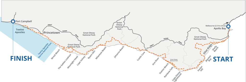
Whilst the trail itself is reasonably well marked there are a few points at which a map is invaluable to make sense of the listed trails, particularly on Day 2 in the Otways forest, and of the low- and high-level options on sections that are tide-dependent. Maps also are vital in the event of having to exit the trail unexpectedly – you’ll need to get your bearings and perhaps work out where the nearest road or shelter is. The definitive map for the Great Ocean Walk is the one shown below, which is a detailed topographic map on a 1:25,000 scale and shows all the surrounding area and useful route notes and information on campsites, altitude profiles, etc. They can be purchased locally in shops and information centres but this should not be relied on as they often run out of stock.
You can purchase the detailed Great Ocean Walk map from the information centre in Apollo Bay and the newsagents on the main Street in Apollo Bay. It is also usually available at the small supermarket on the main street in Port Campbell.

Pingback: The Great Ocean Walk, Victoria | Oz Outdoor Adventures